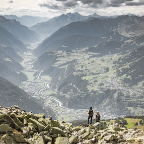
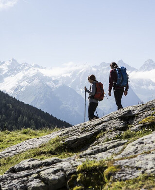
Drive to Greit up to the Tscheylücke. Here, at the beginning of the wonderful high valley of the Pfundser Tschey, a forest path starts on the left at the roundabout up to high mountain meadows. The sign Frudiger points to a path across pastures, through the Swiss stone pine forest up to the summit. A wonderful view of the neighbouring Samnaun group and the holiday resort Pfunds opens up.

Tip: Every Thursday a hiking bus drives to the Tschey
Tour details
2:19h
543m
4.1km
Highest point
2139m
Start point
Tscheylücke Pfunds
End point
Frudiger

Similar Tours

Hiking tour
Ganderbildspitze, 2.863 m
For further information
700m | 4km
Begin: Bergstation Bergkastel
Hiking tour
Lahnkopf
For further information
912m | 3.5h | 5.8km
Begin: Greiter Säge
End: Lahnkopf
Hiking tour
Über den kleinen Mutzkopf retour nach Nauders
For further information
226m | 2.5h | 6.4km
Begin: Bergstation Mutzkopf
End: Talstation Mutzkopf
Hiking tour
Verpeilhütte-Kaunergrathütte-Riffelseehütte-Taschachhaus-Gpeatschhaus
For further information
Hiking tour
Hohenzollernhaus - Sommersteig
For further information
529m | 2.5h | 6km
Begin: Parkplatz Wildmoos
End: Hohenzollernhaus
Hiking tour
Bergkastel via Taschaloch
For further information
804m | 6.7km
Begin: Nauders Zentrum
End: Bergstation Bergkastelseilbahn
Hiking tour
Platzer Alm
For further information
586m | 2.83h | 6.7km
Begin: Tscheylücke Pfunds
End: Platzer Alm
Hiking tour
Seeles Seen
For further information
82m | 1h | 1.7km
Begin: Parkmöglichkeit Riffeltal (an der Gletscherstraße)
End: Seeles Seen