


Mountain Bike Safari Stage 01: Nauders – Pfunds
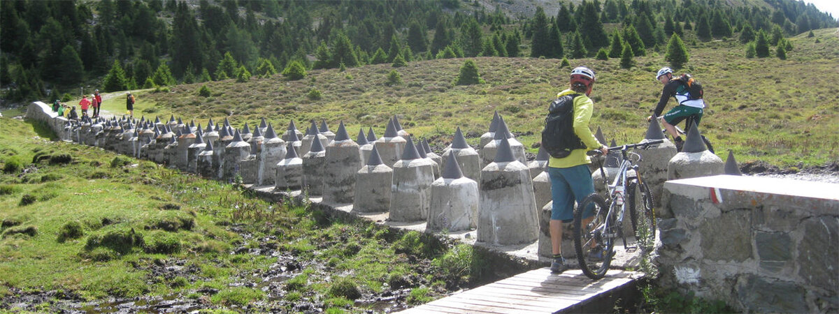
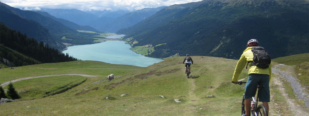


Trail description: This stage starts at the Bergkastelbahn in Nauders, which immediately takes riders up to an altitude of almost 2,200 metres. Shortly after the ascent comes the first highlight – a traverse across the historic “Plamort” plateau, passing tank barriers and bunkers on the way to the Italian border. A stop at the popular “Photo Rock” with views of Lake Reschensee is certainly worthwhile before embarking on the downhill section. Adrenaline junkies should head for Trail 1A and along a section of the “3-Länder-Enduro-Trail” to the village of Reschen. The more relaxed option takes riders along hairpin bends down the gravel road to the restaurant “Mein Dörfl”, located on the shore of the lake in Reschen. This is where the two paths meet again. From there, the main climb of the day begins with a steep tarmac section up to the Falliertkappelle chapel, before the road eases off towards the Reschenalm hut – a good place for a drink and a snack.
On the way back down to the Norbertshöhe there are two options. The first is at Lake Grünsee and takes riders a few metres along the shores of the lake and then along a challenging descent down to Lake Schwarzer See. The second is a classic route starting at Lake Grünsee and leading along a gravel road to Lake Schwarzer See, where both routes meet again. After riding together along a section of forest road, trail riders can take the fast Elven Trail down into the valley, while the others should stay on the gravel road that goes around the Mutzkopf mountain. Both routes meet at the bottom station of the cable car. Riders wishing to add two more trails can do so by taking the Mutzkopfbahn lift up and riding back down the Greentrail or the Kreuzmoostrail.
None of the trails is rated harder than intermediate. Additional cable car rides are not included in the Tirol Mountain Bike Safari Card.
A short ascent on tarmac to the Norbertshöhe is followed by a fast downhill trail (easy) to Martinsbruck in Switzerland. Riders wishing to avoid fast trails can take the tarmac road with little traffic down to Martinsbruck. From there, the route continues along the Inn Cycle Path next to the Inn River. After a quick stop at the old customs office in Altfinstermünz, riders cross the Kajetansbrücke bridge and reach Pfunds, the finishing point of this stage.
Important! The length of the ride and particularly the vertical metres are rounded and to be seen as approximate values. The data was collected with high quality GPS equipment and processed with professional software. However, deviations may arise due to environmental factors and technological differences.


